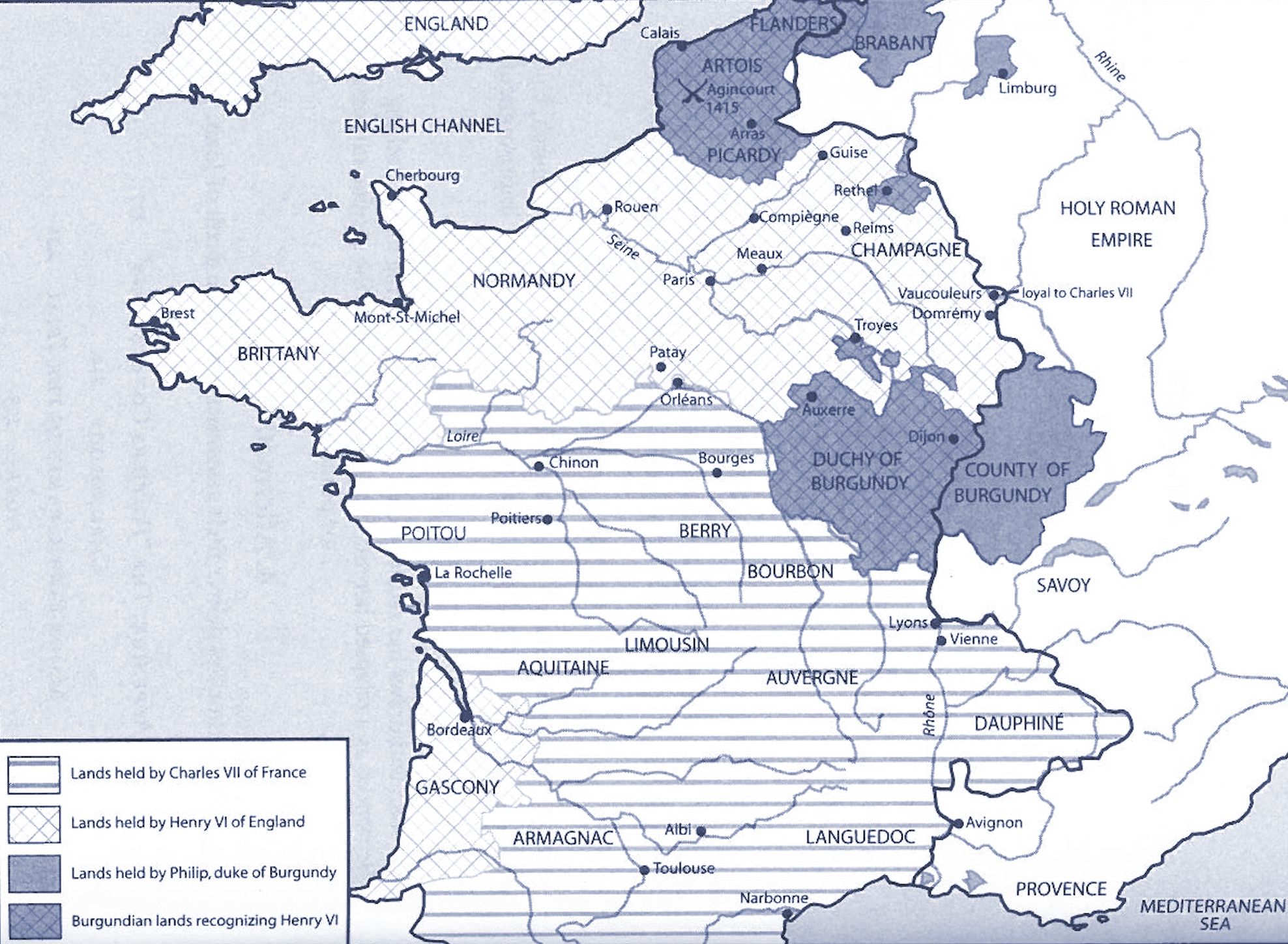
Map showing political division within France in 1429
(Striped areas under Armagnac/Charles VIi control; light-checked areas controlled by Henry VI of England; blue areas under Burgundian control)

Map showing political division within France in 1429
(Striped areas under Armagnac/Charles VIi control; light-checked areas controlled by Henry VI of England; blue areas under Burgundian control)
